HUGE EDIT: Well wouldn’t you know it, this idea has already been thought of and proposed, but not by TransLink. I guess every good idea has been thought of before…
The article is here. And a CBC youtube video here. The original creator, Jeff Malmgren, even picked the same name as me: RiverBus. The Fraser RiverBus Society however, does not appear to be very active. That being said, my proposal appears to be a little more in depth.
The idea for a Fraser River transit ferry system has been in my mind for quite some time. Every day I take the bus across the Queensborough bridge to get to my job on Annacis Island, and every day I sit in traffic, thinking – there’s got to be a better way! There is a better way, and that way is on the river itself. My new plan will make Vancouverites think of the Fraser as the solution, instead of the problem.

So I decided to make a proposal for a transit-oriented ferry system on the Fraser River called RiverBus. Things got a little out of hand and I ended up writing a 50-page report… My report is available in PDF format here. In this blog post I’ll summarize what I designed and calculated in the report.
![]()
BACKGROUND:
Although there are several ferry systems currently in use that serve the Metro Vancouver area, and historically many more, there is no transit-oriented system currently in place on the Fraser River and no passenger-only ferry systems that serve any areas south of downtown Vancouver. Since BC Transit introduced the SeaBus in 1977, there has been no expansion of its services by either BC Transit or TransLink. However, interestingly there was a new proposed SeaBus route from Waterfront to Bowen Island via Ambleside in West Vancouver. This route was proposed by TransLink in 2005, but was eventually scrapped, as TransLink decided it would not be practical.
GOALS:
The goals of implementing a RiverBus system would be to:
- Increase coverage of the transit network
- Provide a connection between the Expo/Millennium Lines and Canada Line
- Alleviate congestion on roads and bridges
- Give life and awareness to the Fraser River
ISSUES:
Despite the obvious advantages, there are numerous potential issues with my proposal, including lack of development near the Fraser River, low population densities, lack of transit anchors, lack of existing infrastructure, and issues with freight train tracks to name a few.
To illustrate one of the issues, here is a graphic of the industrial land areas surrounding the Fraser River:

Most of the land directly north and south of the Fraser River is industrial land. Industrial job density is good, but the unfortunate side effect is that the industrial land creates a barrier for access to the river by residents, who may actually live within walking distance.
INSPIRATION:
The RiverBus is modeled after systems I have used in the Australian cities of Brisbane (Brisbane River ferry, CityCats):

And Sydney (Parramatta River ferry, RiverCats):

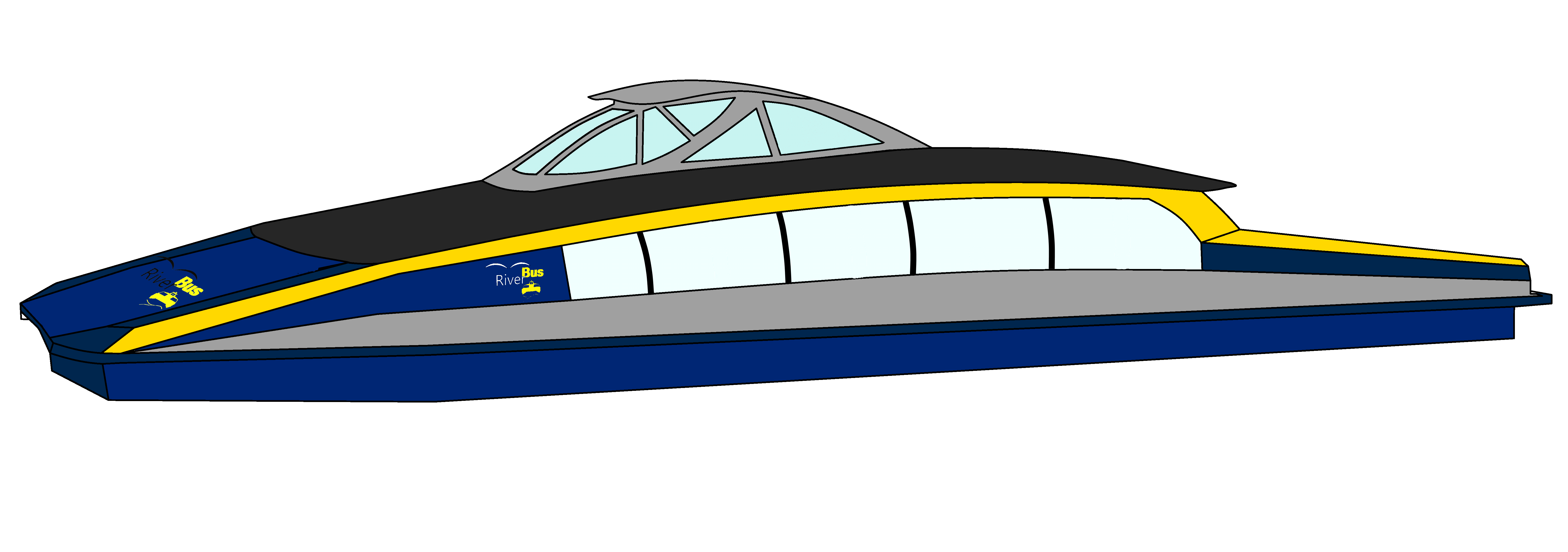
These ferry systems use sleek medium speed and capacity catamarans. Both operate on rivers over similar distances to the RiverBus and both have been highly successful. Other vessels of varying speeds and capacities were also analyzed and it was determined that 150-passenger catamarans with cruise speeds of 25 knots was appropriate for Options A and C, and that 50-passenger mono-hulls or catamarans with cruise speeds of 16 knots were appropriate for Option B.
POPULATION:
First, I completed an analysis of the population surrounding the Fraser River in Metro Vancouver using the QGIS GIS software package and a little help from my brother, Carson Farmer. Using free data I gathered from the BC and StatsCanada Census 2011 online databases I was able to determine what the population is within 400 m. and 800 m. buffers of the river banks. Generally, 400 m. is how far people are willing to walk to get to transit.

|
Population |
||
| 400 m. Buffer | 800 m. Buffer | |
| Option A | 64,019 | 176,051 |
| Option B | 26,833 | 46,359 |
| Option C | 44,253 | 85,269 |
| Option A+B | 72,639 | 191,147 |
| Option B+C | 52,873 | 99,153 |
As a comparison, the 99 B-Line (soon to be replaced with rapid transit) has 68,000 people and 58,000 jobs within a 400 m. buffer of its route. Although it is a special case, the 99 B-Line gets 16.6 million boardings annually.
ROUTES AND TERMINALS:
I developed and analyzed three RiverBus options which may be combined in a total of five different ways.
Option A: Bridgeport Station (West) –> Port Coquitlam (East). The main goal of this option is coverage and to provide a connection between the Expo/Millennium SkyTrain line and the Canada Line at the Southern end.
| Terminal name | Distance (km) |
Difference (km) |
| Port Coquitlam | 28.9 | 0.0 |
| North Surrey | 23.8 | 5.1 |
| Sapperton | 21.8 | 2.0 |
| New Westminster | 18.6 | 3.2 |
| Port Royal | 17.4 | 1.2 |
| Queensborough | 14.7 | 2.7 |
| Victoria Drive | 4.8 | 9.9 |
| Knight Street | 4.2 | 0.6 |
| Bridgeport | 0.0 | 4.2 |
Option B: North Delta (West) –> New Westminster (East). This option can be implemented either on its own, or in conjunction with either Option A or Option C.
| Terminal name | Distance (km) |
Difference (km) |
| North Delta | 11.0 | 0.0 |
| Annacis Island | 7.1 | 3.9 |
| Nordel Way | 6.5 | 0.6 |
| Port Royal | 1.2 | 5.3 |
| New Westminster | 0.0 | 1.2 |

Option C: Bridgeport (West) –> New Westminster (East). This option is a ridership and connection-oriented system, which will serve a small area. It is essentially a “light” version of Option A.
| Terminal name | Distance (km) | Difference (km) |
| New Westminster | 17.76 | 0.0 |
| Queensborough | 14.55 | 3.2 |
| Victoria Drive | 4.76 | 9.8 |
| Bridgeport | 0.00 | 4.8 |

Here is an example of a terminal location, this one located at New Westminster:

And Annacis Island:

SPEED AND FREQUENCY:
I was able to estimate the expected boardings using existing bus route data available from the TransLink website. Also, using an equation I developed based on a very useful spreadsheet created by the RITA of the USDOT (available on the Transit in Parks Technical Assistance Center (TRIPTAC) website), I was able to determine the transit time across the different routes, and compared that to the the time it would take on the current transit network. Given this information, and given a fixed vessel speed and capacity, I was also able to determine the required frequency and thus number of vessels required:
| Option | Western Terminus | Eastern Terminus | Time (min) | Time savings (min) | Peak Frequency (min) | No. of Vessels |
| A | Bridgeport | Port Coquitlam | 74 | 26 | 7.4 | 21 |
| B | North Delta | New Westminster | 56 | 4 | 6.7 | 12 |
| C | Bridgeport | New Westminster | 33 | 20 | 8.0 | 10 |
ANALYSIS OVERVIEW:
Each option was analyzed for expected boardings, hours of operation, frequencies, number of vessels required, transit times between terminals, operating and maintenance costs, and capital costs of terminals and vessels. A cost-benefit analysis was also completed. The results of the analysis are summarized below:
| Capital Costs | Annual Operating & Maintenance | Cost per Boarding | Farebox Cost Recovery | Annual Boardings | Population 400 m |
Goals Achieved | |
| Option A | $108,363,805.00 | $238,430,500.00 | $50.73 | 7.10% | 4,699,780 | 64,019 | 1, 2, 3, 4 |
| Option B | $9,141,300.10 | $14,249,400.00 | $9.26 | 48.20% | 1,538,830 | 26,833 | 1, 3, 4 |
| Option C | $51,512,422.13 | $58,336,666.67 | $13.72 | 29.20% | 4,253,275 | 44,253 | 1, 2, 3, 4 |
| Option A+B | $117,505,105.10 | $252,679,900.00 | $40.50 | 9.40% | 6,238,610 | 72,639 | 1, 2, 3, 4 |
| Option B+C | $60,653,722.23 | $72,586,066.67 | $12.53 | 33.20% | 5,792,105 | 52,873 | 1, 2, 3, 4 |
CONCLUSIONS
Option A would provide excellent coverage, connections, and transit options for those living in Port Coquitlam and Surrey. Unfortunately, it is outrageously expensive to implement ($21.6 – $199.8 million) and operate ($55.9 – $421 million/year) thus coming in at only 7% farebox cost recovery. This option is not viable in the foreseeable future for several reasons:
- Serves too large of an area
- Serves areas with low population densities near the river
- Is too slow due to many stops
- Requires many vessels to achieve desired frequencies
- Requires many vessels to be sitting idle during non-peak hours
Option C solves many of the problems associated with Option A, so comes out more economically viable to implement ($10.2 – $94.2 million) and operate ($19.2 – $97.4 million/year). Farebox cost recovery is 29%.
Option B, while not achieving all the goals set out initially, it is the least expensive to implement ($6.0 – $29.5 million) and also least expensive to operate ($8.3 – $20.2 million/year). Cost recovery for this option is almost 50%, which is about average for TransLink and other transit authorities in North America. However, on its own, this option will only serve about 1.5 million boardings annually.
RECOMMENDATIONS:
My final recommendation is to implement a combination of Option B and C in stages. Option B should be implemented first due to its low costs and Option C should be implemented soon after. Together, these RiverBus routes give the best compromise between coverage, connections, and economic viability.
I hope RiverBus will someday become a reality. Vancouver has such a long-standing history of ferries, transit, and the Fraser River. A transit ferry on the Fraser River would be a great addition to the already excellent transit system in Metro Vancouver.
Other additional files are all available here.
Thanks for reading!
