Rome, Lazio, Italy (Roma)

Roma, home of the dolce vita and gelato! Rome is home to an urban population of 3.8 million people and is one of the most hectic, beautiful, and historic cities I’ve ever been to. While I didn’t exactly experience la dolce vita, I did get to use some diverse transit options during my visit in April 2014.

Rome 1 Rome 2

TYPES OF TRANSIT

The greater Rome area has four main types of transportation options working in parallel: bus services, an underground metro system, a network of commuter rail lines, and several tram (streetcar) lines. Additionally, Rome’s main airport, Fumicino, has a short automated people mover.  Here is a couple shots of the people mover, a traveler’s first experience with transit in Rome:

People Mover 2People Mover 1

Rome also has many long-distance bus and rail connections which allow easy connections to other cities throughout the Italian peninsula and Europe.

URBAN RAIL (FERROVIE METROPOLITANE)

Regional and urban rail lines spread out from Rome in all directions; many people use these rail lines to commute to and from the city on a daily basis. It is possible to use the urban (or regional) rail lines to get around within the urban core of Rome, although the trains are not as frequent as bus routes or the metro system. The busiest station is Termini which also has connections to numerous bus routes and both lines of the metro system.

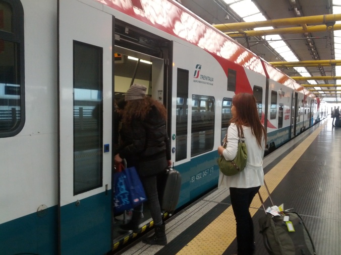
I only used urban/regional rail once to get from FCO airport to Termini, on a train called the Leonardo Express. This train was fairly new with lots of luggage racks to carry your travel bags and convenient electrical sockets. The express train takes 32 minutes; it runs direct from the airport to termini and costs 12 Euro.  There is also a local version of this train.

Here is the commuter rail and metro map:

[Unlocked] mappa ferro.FH11

Urban Rail 1

Urban Rail 2

METRO

Rome’s underground metro, first constructed in 1955, is a pretty standard heavy rail system with just two lines operating as of 2014, imaginatively called Linea A (Orange) and Linea B (Blue). A third line, Linea C (Green), is under construction and will be opening at some point in time. Although not technically part of the metro, the Roma-Lido train line is essentially another line. This line uses vehicles that look very similar to the metro cars and operates within the urban area of Rome. The only difference is that it is not underground, and slightly less frequent than the metro.

Metro Exterior

I used the metro 3 or 4 times during my stay in Rome. I only used Line A as that was the line that the place we were staying at was closest to (Ponte Lungo station).

Metro Interior 2 Metro Interior

The stops are announced in Italian and English via the PA system, and the train interiors (on Line A) were reasonably comfortable with great maps and digital displays. One very cool thing, Rome’s metro trains are very long and it’s possible to walk through the entire train, end to end, as all the cars are articulated.

The stations are fairly well laid out, with pretty average, but adequate signage.

Overall I did not find the metro experience to be that great. The trains were always crowded (even in off-peak times) stations are poorly lit and there is graffiti everywhere including the exteriors of the metro cars. Also, the system is too small for a city with the population of Rome! Only 40 km of rapid transit constructed over 60 years?? As a comparison, Vancouver currently has 70 km. Rome’s system is simply not up to par with other major European cities. Having said that, if the Metro turns out to be of use to you then by all means use it, you will not regret it!
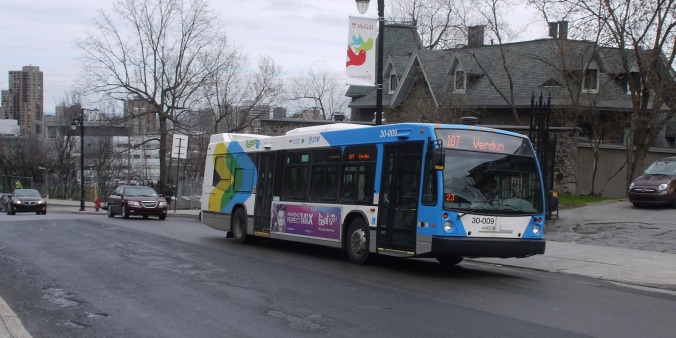
Metro Station Entrance station interior

BUS

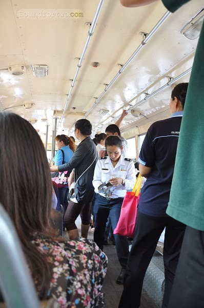
During my stay in Rome, I often found that taking the bus was more convenient than the metro. While the metro was a 10 minute walk from our place via a confusing street network, the closest bus stop was a mere 2 minute walk. The best route for us was the 628 which went directly to downtown Rome via one of the busiest transit points, Piazza Venezia. As we were there on a holiday weekend, we did have to wait for quite a while for buses several times.

standard bus ext

Unlike the metro, I found the bus experience to be quite pleasant. Buses were not too crowded, reasonably frequent and quick (despite Rome’s horrific traffic), with new, comfortable vehicles. And where else can you ride a bus under a 2,000 year old Roman aqueduct?

bus interior 2 aqueduct

One VERY IMPORTANT thing to note is that you MUST PRE-PAY before getting on, and then validate your ticket when you get on the bus. Roman buses do not accept any form of currency. If you don’t, you risk getting a substantial SPOT-fine.
payment machine

Stops were announced, depending on what kind of bus you got on. For us, that was just one bus out of 4 or 5 trips, so don’t count on it. Usually the buses just displayed the terminus station.

Also, don’t count on a smooth ride either. Roman roads are charming but very bumpy, and Romans drive like they want to die. You may need to hail the bus driver, and buses generally do not pull over to the side of the road.   Here is the bus stop sign:

Bus Stop

Rome also has pretty cute mini-buses:

mini bus

TRAM (STREETCAR)

Like many cities, Rome used to have an extensive tram system that has slowly been replaced with diesel buses over the years.

rome-tram-map

Now Rome has 6 tram lines. I took line 8 from the starting point, Piazza Venezia, across the Tiber River to Trastavere, which is a very cool neighborhood. Although trams have their issues, I always enjoy riding in them. Trams are a very romantic way to experience the city, with the added comfort of knowing that your journey will not be diverted in an unexpected way (such as with a bus). Just don’t expect them to be quick (or reliable). After dark, the frequency of the trams drops considerably.

tram 1 Tram_troma_stanga1

You should remember to prepay before getting on the tram, despite the fact that there is a ticket vending machine on board, these machines are broken more often than not.

One annoyance is that the tram schedules are NOT integrated with Google maps, unlike the other transit options in Rome.

PAYMENT

As previously mentioned, in Rome you have to prepay before getting into any type of transit vehicle. At each metro station there are ticket vending machines, and often a human vendor if you prefer to talk to a real person.

Buying a ticket can be a little stressful for a few reasons, especially at Termini because:
It is a very busy station, with many people getting tickets.
Italians don’t wait in line, so they will probably just barge in front of you.
The machines are often broken, and although they say they accept bills, that is a lie! They MAY accept 5 Euro notes, but usually just coins.

Ticket Machine
There are gypsies standing next to the machines trying to “help” you (i.e. annoying the f*** out of you) in the hopes of you giving them money? I also suspect they are the ones that damage the machines, as there is a lady there with change.

Once you get a chance, you might as well buy a bunch of tickets, as you can always use them later for the bus, metro, commuter trains, and trams.

Additionally (and this goes for all Italian cities) you can buy tickets at almost any Tabacchi (Tobacco store), which is odd, but there are many in Rome.

Unfortunately, we did not realize that it’s impossible to pay with coins on the bus, which caused a great deal of embarrassment when we got on one for the first time. Luckily there were no ticket checkers, so we got a free ride.  Although I fully support prepaying for buses due to the many benefits, as tourists we were basically forced to ride for free. Since it was a holiday all the tobacco stores were closed and there was essentially NO WAY for us to pay for a ticket (if we wanted to take a bus). It would have been nice if there was an option to pay on board.

When you purchase a single ride ticket (1.50 Euro), you have 100 minutes to complete your journey and can transfer as many times as you wish to buses, trams, and some trains but you only get one ride on the metro.

Fleet/equipment 8.0/10
GOOD: Most of the rolling stock (except some regional trains) was new, buses are great, metro line A trains were actually fantastic, diverse fleet of options
BAD: Some buses were pretty beat up, many regional trains have seen better days

Availability 6.7/10
GOOD: Overall decent coverage with the bus network, underground metro and trams,
BAD: Not too much coverage in the old Rome center, relatively low metro frequency, low tram frequency after dark, not enough rapid transit

Wayfinding/Presentation 8.8/10
GOOD: Metro stations and trains have lots of maps, there is linear station charts and some information on trains, metro system is inherently simple, there is English signage in every station
BAD: Bus stops are not announced, not many maps on the buses, no free take-away maps

Civility 5.5/10
GOOD: Underground stations offer some respite from the hot Italian sun, certain stations have nice amenities (Termini especially)
BAD: Gypsies, poor lighting, too much graffiti, most trains and stations were overall pretty grubby and not well maintained

Overall 7.2

Despite my less than stellar reviews, we actually got around just fine in Rome. It was a very busy weekend (Easter holiday weekend) which may have contributed to the busyness of the metro. Rome’s public transit is overall OK. Not great, but certainly better than most cities of its size and population in the United States. Also, with the addition of Line C, Rome’s metro will improve greatly.

linea c

The line has been long coming, and has been delayed continuously as construction crews constantly unearth ancient history under the eternal city. Travelers can certainly make use of public transportation in Rome without any hesitation and experience a little bit of life as a modern Roman.

Koh Samui, Surat Thani Province, Thailand (กาะสมุย)

Koh Samui is an island off the east coast of Thailand. I travelled to Koh Samui in spring 2011 on a tour of South-East Asia. Nearby are the islands of Koh Phangnan and Koh Tao, and the city of Surat Thani on the mainland.

f22067264f22464896 - Copy

TYPES OF TRANSIT

Actually there is no official transit system on Koh Samui. All transportation is either by taxis, scooters, private vehicles, or songthaews. Songthaews represent the closest thing to a public transit system on Koh Samui and they seem to work… at least somewhat well.

“LIMOUSINE” SERVICE

To get travelers between the ferry terminals, airport, and hotel there are a number of private taxi companies operating “limousine services” which take the form of 8-9 passenger vans. The vans travel to and from the hotels when they fill up with travelers. It costs 120 Baht ($4). Here is my original ticket:

Limosine Ticket to Chaweng LimosineLimosine Prices
SONGTHAEWS

I took the Songthaews to get around on Koh Samui several times.

Songthaew

Taking the songthaews is a little nerve racking for a few reasons:
You are in the back of a truck
There are usually no other tourists
The driver probably has no training
There is no map
There is no stops
There is no schedule

On Samui it was simple enough to take the songthaews as the island is not very big. Basically there is one main ring road that surrounds the island and the songthaews travel in both directions around this road, shown in blue below:

Island Map


All of the major urban centers on the island are accessible by the ring road, so it is actually ideal for transportation. To use the songthaews you simply wait on the side of the road until one is driving by and then wave to the driver. The direction and name of the towns are usually painted on the side of the truck. The cost depends on the distance travelled but on Samui it was usually less than 60 Baht or so ($2). Then, get into the back of the truck and sit with the rest of the locals. Usually when you get to the various town centers, the driver will announce it; to disembark, simply say “I want to get off now” or something to that effect. You can probably get off anywhere along the route, but in my experience the drivers would generally stop at the same spot along the road at each of the urban centers.

The two main routes on Samui are:
1. Nathon – Mae Name – Bo Phut – Chaweng – Lamai
2. Bo Phut – Fisherman’s Village – Bangrak – Plai Laem – Cheong Mon – Chaweng

Sonthaew Interior

The seats are not particularly comfortable and having no schedule or map makes them a little unpredictable. However, the songthaews are very frequent and I had no trouble getting around on the island.

FERRIES

There are a few competing companies that service the islands, here is a map of the competing services:

Some Ferry Routes

The three main ones are:

1. Lomprayah – new, high speed catamarans

Lomprayah 2 Lomprayah Interior

2. Seatran – Relatively new and nice large mono-hulls

Seatran

3. Songerm Express Boat Co. Ltd. – Older, kind of shitty mono-hulls

Songserm

I ended up taking all three eventually. The main terminal at Samui for Lomprayah is located in Mae Nam on the North-West side of the island, and Seatran has their terminal in Bo Phut.

Firstly, I took the Lomprayah high speed catamaran service to get to and from Koh Phangnan for the famous full-moon party. The catamarans made short work of the 20 or so kilometers between the two islands. The whole journey was less than 30 minutes and was mighty fun. I’m a big fan of boat transit, and Lomprayah’s high speed catamarans were my favourite transportation option that I used during my South East Asia tour.

After a few more days of lounging around on Koh Samui I decided I would like to get my scuba license, so I took a another ferry over to Koh Tao from Koh Samui.

f22216512

To get to Koh Tao, I took Seatran’s Discovery ferries. Their vessels are definitely comparable to passenger ferries I have used in North America. The service was on-time, quick, and comfortable. The ferries had TVs playing information, food services, and decks where one could lounge – although it was quite windy. The view was spectacular! Here is my original ticket:

Samui-Tao

I also used Seatran to return to Koh Samui after I got my scuba certification. I spent a few more days in Samui then headed to Bangkok. To get to Bangkok this time I took the Songserm express boat service.

They can sell you a joint ticket, which is good for travel from Samui all the way to Bangkok: Samui to Surat Thani by boat and then coach bus to Bangkok. In total it takes 12 hours or longer. This combination ferry/bus ride was probably my least favourite travel experience in South-East Asia. The Songserm ferry was old, shitty, and slow, crowded, and offered no extra luxuries. It was however, by far the cheapest way to get to Bangkok from Samui, at only about 600 Baht in total ($20), whereas Lomprayah charges 1,300 Baht ($43) for the same journey.

In Thailand, you get what you pay for. Songserm was incredibly disorganized the entire way, at Surat Thani I ended up waiting for several hours in the middle of nowhere for the coach bus to show up. I’ve also read some accounts of people having their luggage rifled through while traveling on this service.

Here is my original ticket:

Samui-Bangkok

Next time I would take the Seatran or Lomprayah service to Don Sak (near Surat Thani) and then the State Thai Railways overnight sleeper train to Bangkok. This option is much more expensive, but will give you a better night’s sleep, a safer trip and more interesting journey, and a real Thai train experience. Let’s face it, rail beats road every time and catamarans beat slow boats every time!

FINAL THOUGHTS

While Koh Samui, Koh Phangnan, and Koh Tao do not offer any sort of planned or integrated transit system, there are ways to get around. My review is only of the songthaew services:

Fleet/equipment 2.5/10
Songthaews are converted vans with some seats, they are better than walking in some situations.

Availability 4.5/10
Actually not too bad! Songthaews continuously circulate on Samui, connecting all the major urban areas. You would be hard-pressed to use songthaews alone without also owning a scooter on Samui.

Wayfinding/Presentation 1.0/10
Occasionally the trucks had the directions and/or stops painted on the side.

Civility 2.0/10
I doubt tourists would ever feel safe in songthaews in their home countries, but compared to a tuk-tuk in Bangkok, songthaews are Volvos.

Please note I finally decided to not bother rating on cost, as it is not an important metric for the overall rating of a transit system.

Overall 2.5/10

While I can’t say that the Songthaews are an acceptable transit system by western standards, they do kind of work in Thailand. The locals and some tourists are able to get around using these services, so in that way, they do the job.

However, I believe Koh Samui would benefit greatly from a couple of official bus routes with real maps and stops operated by some sort of government agency, or private operator. Having a map and a timetable for visitors to use would get more people using transit, and less people riding around on dangerous scooters – usually without helmets. Perhaps a few retired buses from Bangkok would do the trick.

Montreal, Quebec, Canada (Montréal)

Montreal is a fantastic city with fantastic transportation. I’ve been to Montreal twice, and have used the transportation systems quite extensively each time I was there.  I took this photo of the downtown area from the top of Mont-Royal in my latest visit in May 2014:

P1140857

TYPES OF TRANSIT

Montreal has three types of transportation working in parallel: bus services, an underground metro system, and a large network of commuter rail lines serving outer suburbs.  Montreal also has long-distance bus and rail connections which allow easy connections to other cities.

Here’s the frequent transit network map, which includes bus and the metro:

Montreal FTM

And the commuter rail network:

Monreal Rail

BUS

I took buses quite a few times during my stay in Montreal. Most visitors will end up taking the bus at least once if they use public transportation in Montreal, as route 747 is the main route to and from Pierre Elliot Trudeau (YUL) airport.

The 747 route runs as an express bus with little stops outside of the main downtown core, has convenient luggage racks for passengers with lots of luggage, and a simple direct route.  The first stop after the airport is the Lionel-Groulx metro station which offers a connection to the green and orange lines of the metro.

747 1747 2

I also used a few other routes within Montreal, mainly route 55 which runs from the plateau area (where I was staying) towards downtown Montreal.   I had a lot of success with the buses, and never had to wait more than 5 minutes or so at any point.  Montreal’s buses are mostly usually pretty new diesel vehicles made by Nova Bus and can be found as standard, articulated, and mini vehicles.

Bus Ext. Normal  P1140830P1140876

Interiors are good too since the buses are pretty new

Bus int 2Bus Int 1

Bus stops are easily identifiable and are complete with all the requisite information.

Typ Bus Stop

Stops are NOT announced on Montreal buses, nor is there any kind of digital display indication the next stop.

METRO

Montreal’s rubber-tired metro system, first opened way back in 1966, is the heart of urban transportation within Montreal.  There are a total four lines: green, orange, yellow, and blue.

Metro rubber wheels


Metro Ext

Many of the trains are the original 1966 vehicles, with a few slightly newer ones from the 1970s.  Even though the trains are nearing 50 years old, you really wouldn’t know it.  The trains have updated, modern interiors with prominently displayed maps all over the place.

Metro Int Int Map

The stops are announced in French only via the PA system.  I also noticed that the doors slam open and shut really fast, just like the Paris metro.  Make sure you’re quick to get on and off!  The vehicles can be quite crowded and narrow; it is NOT possible transfer between cars within the train.  Brand new trains, called Azur, are scheduled to arrive in 2014.  These trains will really bring the metro into the 21st century.

Montreal Azur

The Metro stations are usually quite well lit, with easily recognizable signange and logos throughout urban Montreal.  Here is an example of the exterior of the stations:

IMG_20140504_141017

Montreal’s metro is one of my favourites.  It goes everywhere I need to go, is frequent, fast, and safe.  My brother’s house is located a short walk away from Sherbrooke station, here:

Montreal Sherbrooke Station

The downtown core of Montreal is only a few stations away by metro.  One of the reasons I like this metro so much is because it’s entirely underground, as a subway should be!  The transportation systems complement the urban planning of Montreal’s neighborhoods, but do not dominate.  The stations are there where you need them, but out of sight, safe underground where it’s warm and dry.  And sometimes in the summer it’s a little too warm – the metro cars are not air conditioned!

COMMUTER RAIL

There are five different regional/commuter rail lines serving greater Montreal, with one under construction (see map above).  The oldest of which, the Deux-Montages line, dates back to 1918. This is also the only line which is electrified because it travels through a tunnel.

AMTDM

During both my stays in Montreal I didn’t take the commuter trains at all.  My stays in Montreal have centered solely around the urban core where the metro is the main way to get around.  As in most major cities, Montreal’s commuter rail is designed to get commuters to and from the downtown core (central station) from the various suburbs.

PAYMENT

The regular fare is $3.00, but more if using the trains to get out to the suburbs.  Each metro station has an attendant and usually one or two machines where you can buy one-time use passes, day or monthly passes etc.   Coins are accepted as payment on the buses.  One time use passes last for 90 minutes.

BoothTurnstile

Once you have a pass you can transfer freely to any other mode of transport as many times as you like (this is the best possible situation).  The 747 fare is $9.00, but if you get a 24 hour pass or more (minimum $10) the 747 is included.  On my latest trip, I spent $23 on transit in Montreal. What I SHOULD have done is gotten a 3-day pass for $18, which is a great deal and includes access to the 747, but unfortunately I didn’t think about that at the time!One time use tickets are fed into the machines whereas the 24 hour or greater passes are contactless.Finally, for people who want to have a monthly pass or reloadable card, Montreal has the Opus card, which is their more durable contactless smart card system.Various fare receipt media, including the Opus card:

pass2

Fleet/equipment   9.0/10

GOOD: Metro, bus, and trains: perfect system! Most buses seemed quite new, luggage racks on airport bus

BAD: The metro fleet is a little old, i.e. no air conditioning and limited standing space

Availability   9.5/10

GOOD: I never waited more than 10 minutes across all types of transit, lots of metro stations downtown

BAD:  Off-peak metro times are relatively low compared to automated transit

Simplicity/Presentation   8.8/10

GOOD: Metro stations and trains have lots of maps for finding your way, trains have lots of maps and information, system is inherently simple

BAD: Bus stops are not announced, not many maps on the buses (except 747)

Civility   7.5/10

GOOD: Stations were mostly well-lit, accessible, with great French signage

BAD: As they were designed in the 1960s, most of the stations are not accessible, and a little dark and old which can invite graffiti and homeless weirdoes.

Overall   8.7/10

Final thoughts: Despite the 8.7 score, I actually think Montreal’s system is pretty much perfect.  While people from Paris, London, or Tokyo may think that the underground system is miniscule, it’s absolutely the right size for Montreal.  The classic system of underground metro, heavy-rail commuter trains, and bus services works so well around the world it’s a wonder other cities do anything else. Think of all the major world cities famous for good transportation: Paris, London, New York, Tokyo, Seoul… What do they have in common?

Grade-separated  metro/subway, commuter/urban rail to the suburbs, and bus/streetcar services to complement them.  Perfection!

Bangkok (กรุงเทพมหานคร), Thailand

INTRO

When most people think of Bangkok (Krung Thep) and transportation, they will most likely picture tuk-tuks, taxis, scooters, and long-tail boats.  For the most part, that is a pretty accurate description of public transportation in Bangkok, and South-East Asia.  Most South-East Asian cities depend on individual vehicles to move people around, with the exception of a few metropolises such as Singapore, Kuala Lampur, and Bangkok.  Bangkok actually has a pretty exceptional transit system, with a heavy rail subway, elevated light rapid transit (BTS), and extensive bus services.  Unfortunately, tourists rarely use these excellent transit systems, and mostly rely on sketchy tuk-tuks and taxis to get around.

Khao San Road


Gand Palace 2

I traveled to Bangkok in spring 2011 and I used more transit than most tourists.

TYPES OF TRANSIT

Bus

Bangkok has a lot of buses.  I took a bus journey in Bangkok one time, quite by accident!  During my trip I’d had a few difficulties with rearranging my flights, and at some point I needed to speak with a representative of the airline.  The only place I could do so was at the airport, so I went to the airport (without going to catch a flight).  Getting there was pretty straightforward, as I got into one of the many different airport shuttle buses operating on Khaosan Road where my hotel was.  These airport shuttle buses are pretty convenient for travellers going to the backpacker areas as it is a direct connection for only about 100 baht or so.

bangkok-airport-taxi

It takes about an hour to get to the airport.  After I finished my business at the airport, I decide to take a shuttle bus back to my hotel on Khaosan Road.  At the airport I got a little lost because I wasn’t actually leaving out of the “departures” area.  Normally there’s plenty of signage to get to the shuttle buses, and finding them is a breeze.  Eventually I asked an airport attendant, and he pointed me to the “right direction” for the shuttle buses into the city.  Eventually I found myself on a shuttle bus going towards the main bus depot for the airport.  This shuttle bus is a free service to connect travelers to the transportation area at the airport.  While technically correct, it wasn’t where I wanted to go.

shuttle bus

Now I was a little flustered, as I hadn’t planned on taking transit from the airport and it was a little late to go back.  I was not prepared, I did not have much of a grasp on what transit was like in Bangkok, nor did I know the city very well (or at all).  Luckily for me there was a bus depot attendant’s station.  I explained to the guy working there where I wanted to go, and he handed me a pre-printed instruction sheet with a small map and information on which buses to take.

Apparently I wasn’t the first lost tourist with no clue where I wanted to go except “Khaosan Road”.   I was 100% for sure the only non-Thai person in that depot.  There was not a tourist for kilometers, and I did get some funny looks.  A very strange woman who spoke very good English but appeared to be homeless spoke to me for some time about random things.  Eventually a station police officer spotted her and chased her away.  He asked me if I was OK and I said of course, yes, she was just talking!

ptcenter bangkok_suvarnabhumi_shuttle_bus

Although there is a newly built (in 2010) ART rail link to the airport, it does not connect easily to the Khaosan Road area.  To get to where I needed to go I had to take bus number 555 (air-conditioned) and transfer to bus number 60 (ordinary) at the At Narong Expressway.

Sunlong_buses_in_Bangkok Ordinary Bus

Nowadays the transit data for Bangkok is integrated with Google Maps.  My journey looked like this:

map

Transit time is about 1 hour 30 minute.  The route 555 bus was quite modern, comfortable, and new.  I was quite impressed that there was a TV with sound on board showing advertisements and information.   Most of the time there was K-Pop music blaring, as a K-Pop festival was coming to Bangkok that month.  Despite being a large capacity articulated bus, the one I took was jammed to the gills – I had to stand with the locals.

One interesting thing is that the fare collection is done by a person on board.  Every time somebody gets on board, the attendant finds you to collect the fare which you pay for in cash.  I really have no idea how she managed to keep track of everybody coming and going.

Bus 29 Conductor Bangkok Thailand

Once again, I was 100% for sure the only non-Thai person on that bus.  Lots of stares, and a few people talked to me.  After about an hour of travelling on the bus the fare collection lady told me that this was my stop.  Right in the middle of the city, in an area that I did not know well, I got off the bus and waited for another.  After about 10-15 minutes, the bus that I wanted came by.  When this next bus (route 60) got close to Khaosan Road a guy on the bus said:

“Hey do you need to go to Khaosan Road?”

He had made the correct assumption, so I said “Yes!”

“This is your stop!”

That wasn’t so hard, but I got lucky thanks to the help of locals.  I had made it back, and had quite the adventure in between.  It is absolutely worth it and dirt cheap to take transit from the airport, just make sure to at do at least SOME research first…  Next time, I would:

  1. Not stay on Khaosan road (it’s kind of horrible)
  2. Take the ARL transit option into the city

The buses in Bangkok are run by the Bangkok Mass Transit Authority (BMTA) or a variety of private operators.  In all there are around 470 different routes.  The newer, air-conditioned buses are made by various Japanese and Korean manufacturers. The older non-air-conditioned buses are being phased out.

Bangkok also has a newly implement BRT system (which I did not get to use) running through the Bangkok CBD.

bangkok-brt-bus3

RAPID RAIL TRANSIT

Bangkok has a fairly extensive rapid rail transit network that, like Tokyo, consists of several different rail systems:

A heavy rail system operated by the Bangkok Metro Public Company, known as the following:

    1. Metropolitan Rail Transit (MRT)
    2. The Blue Line
    3. The Bangkok subway/underground
    4. The Bangkok metro
    5. Rotfaifa mahanakhon (metropolitan electric train)
    6. Rotfai taidin (underground train)

An elevated, automated, light rapid transit system operated by the Bangkok Mass Transit System Public Company Limited known as:

    1. Bangkok Mass Transit System (BTS)
    2. Skytrain
    3. Rotfaifa
    4. The Elevated Train in Commemoration of HM the King’s 6th Cycle Birthday

A heavy commuter/express rail line operated by the State Railways of Thailand (SRT) called the Airport Rail Link (ARL).

System map in 2011:

5434511_f520

Regrettably, I did not take the MRT or ARL during my stay in Bangkok.

The MRT is currently just one underground standard gauge 21 km line with 18 stations; daily ridership is 240,000.  Two extensions are planned and under construction and supposedly there will be a total of 7 lines in the MRT by 2019, including some monorails.

MRT_subway_-_Bangkok

At the time I was not as much of a transit enthusiast as I am now, and actually for going to tourist sites, the subway is not necessary.  However, the rail rapid transit that I did use in Bangkok is the BTS.

The BTS is very cool and a quick way to get around town.  In 2011 there were two lines operating:

Sukhumvit Line: Mo Chit – On Nut

Silom Line: Sephan Taksin – Wong Wian Yai

img_2103

Since then the lines have been extended.

Payment is slightly complicated as it is distance based.  I took the BTS to get to the Chatuchak weekend market (Mo Chit Station).

BTS_Mo_Chit_Station

DSC_6034

This station is only about 5 minutes from the market itself.  The Chatuchak market is insane, and probably one of the coolest places I’ve ever been to.  If you ever find yourself in Bangkok on a weekend, go to this market, and take the BTS like the locals do.  I also got off at the Siam Plaza mall once or twice.

The BTS has around 600,000 users daily and runs Siemens, Bombardier, and Chinese Changchun EMUs on standard gauge tracks.  The sleek modern BTS vehicles pass by slum areas, “entertainment” plazas, ancient history, and derelict sky scrapers.  The automated system is capable of carrying 40,000 passengers per hour, and is often quite busy.  Unlike a lot of Bangkok (certainly Khaosan Road) the BTS vehicles and stations were clean, safe, and user-friendly. There was plenty of English signage as well as Thai.  Food and drinks are banned from the BTS and people actually abide by this rule, amazing!  I saw quite a few non-Thais while I was travelling on the BTS, certainly a lot more than on the bus.

The third system, the ARL, was opened in December 2010.  The system provides a link between the main international airport, Suvarnabhumi (BKK) and the BTS and MRT systems in Bangkok.  The trains run on standard gauge tracks and run as express for 150 Baht or Local for 15-45 Baht to Makkasan station.

ARL_Bangkok_CityLine1

BOATS

Although not on a coast, Bangkok has a major river running through it – the Chao-Praya River.  For centuries the people of Bangkok have used the river and various canals to transport people and goods.  The same goes for now.  The privately operated Chao-Praya express boats serve as the main transportation system on the river.  The wooden boats are capable of carrying 90-120 people. Forty thousand people a day use the express boat service.

ChaoPhrayaExpressBangkok

Other boat services include long tail boats which operate over shorter routes.

OTHER MODES

While not mass transit solutions, smaller private vehicles also make up a huge portion of the publically accessible transit available in Bangkok. Tuk-tuks, taxis, Songthaews (small vans or trucks), cyclos, and even random personal vehicles and motorbikes make up this diverse “fleet”.  During my stay in Bangkok and South-East Asia I eventually tried all these different options.  Tuk-tuks are extremely fun to ride in, but are definitely dangerous and have a few unfortunate side effects:

You breathe in a lot of pollutants

  • The drivers will 100% for sure try to get as much money out of you as possible (if you are not Thai)
  • You will be stuck in traffic

Official taxis in Bangkok are quite excellent and very cheap (if and only if you can convince the driver to use the meter).  Traffic is perpetually bad and you will sit in the car for a long time. Songthaews are basically just pick-up trucks with seats in the back that circulate on fixed routes. I’d say they are slightly better than taking a tuk-tuk, but not as comfortable as a taxi.  Cyclos seem to be only for tourists, and aren’t particularly fast or comfortable, but are pretty fun.  Finally, the plethora of random personal vehicles waiting to drive people around can actually be pretty convenient.  Usually a team of motorcycle “taxi” drivers hang out around the various BTS and MRT stations waiting for customers.  If you live within a kilometer or so they will drive you right to your apartment – as long as you don’t mind sitting on the back of a motorcycle driven by a stranger with no helmet!  They charge about 30 Baht (about $1).  The motorbike taxis offer a not-bad solution to the “last mile problem” with transit.

PAYMENT

Back in 2011, payment across all modes of transportation in Bangkok was usually done in cash.  Transfers were not free, nor did it matter as the payment systems were based on distance.  For the entire transportation network as a whole, the payment system is very complex as it also depends on mode of travel, distance, and route.  The bus fare structure is particularly complex:

bus fare struct

Of course, all of these prices seemed very cheap to me.  The most you can pay riding a Bangkok bus is 23 Baht, which is about 80 cents.

Since 2012 there has been the option to use a contact-less smart card called the Rabbit Card, initially on the BRT and BTS.  Later, users were able to use it on the MRT as well.

For another example, this is the BTS fare structure:

BTS fare structure

All transit in Bangkok is very inexpensive for western tourists.

RATINGS

Recently I read Jarrett Walker’s book [Human Transit], which complements his extremely popular and professional blog about transit.  In his book, Mr. Walker stresses the most important factors that one should look for in a transit system, specifically:

Stops/Stations

  • Connectivity
  • Frequency
  • Span
  • Speed or Delay
  • Fare
  • Civility
  • Reliability
  • Simplicity
  • Presentation (i.e. mapping, wayfinding etc)

Fleet/equipment                8.0/10

GOOD: Diverse multi-modal (train, elevated train, subway, buses, boats, private vehicles), for the most part very clean, new, high-tech

BAD: Over reliant on private vehicles, non-air conditioned buses are dreadful

Availability                       5.5/10

GOOD: Lots of options available at the airport, BTS, MRT, BRT, and ARL are very frequent, buses are extremely frequent

BAD: Small rapid transit coverage compared to other Asian mega-cities, NO coverage to some popular tourist areas (Khaosan Road), only 4 rapid transit lines in 2011.

Simplicity/Presentation      5.5/10

GOOD: The BTS stations have lots of maps for finding your way, and plenty of signage and announcements in English and Thai, buses have information displayed on screens

BAD: I actually had a tough time finding maps showing the different transit options together, at the time there was no smart-card option, there is a plethora of buses which do not appear to operate on a grid system

Civility                                       6.0/10

GOOD: Stations were very clean, safe, well-lit, accessible, great English signage, with convenient small shops

BAD: Outside of MRT, MTS or BRT stations, the bus stops are just sides of the road with little passenger amenities which does not make me feel safe

Cost                                5.4/10

The typical fare for a BTS ride is about 35 Baht ($1.20) and the average salary in Bangkok/Thailand is widely quoted at $7,000 USD/year.  According to my algorithm, Bangkok gets 5.4/10 for cost, when compared to a typical fare in New York City.  Consider that the fare in Bangkok is around 1/2 of that in New York, yet the average salaries are more than 11 times less.

Overall 6.1/10

FINAL THOUGHTS

Bangkok is a wonderful and vibrant city to visit, although I probably wouldn’t want to live there just yet.  The perpetually traffic-jammed roads are a huge problem and unfortunately transit infrastructure has not grown in pace with the population of the city.  Despite that, there is currently a great variety of transit options in the city and a huge amount of construction happening within the next few years.  The additional train lines being constructed all around Bangkok will absolutely transform the city into a very habitable, thriving metropolis. Bangkok is now known for tuk-tuks and taxis, but soon that will be replaced with memories of a useful and modern metro system.  If you visit Bangkok make sure to use transit as much as you can.  While taxis and tuk-tuks are cheap and comfortable, the transit options are even cheaper and more enjoyable.

Metro Tokyo (東京都), Japan – Getting around Tokyo

Once I was in the city, obviously I needed to get around. Renting a car in Tokyo would be outrageous and incredibly difficult for a tourist.  As a result, everyone takes transit.  The map my hostel gave to me proved to be one of the most useful tools I had during my stay in Tokyo, and they had a seemingly endless supply of them.  Here is a photograph of mine:

image

The official PDF from Tokyo Metro can be found here:

http://www.tokyometro.jp/en/subwaymap/pdf/routemap_en.pdf

As you can see (hopefully) my home station, Kuramae (蔵前駅) is circled, and is part of the Toei Asakusa Line and Toei Oedo Line.

One important thing to note in Tokyo is that almost all transit is operated by private or semi-private companies. Each part of the system is operated independently and profits are generated separately. There are so many different operators of transportation in and around Tokyo that it is a wonder that it all works together at all. But it does, and it does so quite well.

PLEASE NOTE: For some reason I took almost no photos during my stay in Tokyo, something that I really regret.  Most of the photos on here are borrowed from somewhere else.

TYPES OF TRANSIT

In Tokyo transportation is dominated by rail and famously the subway. However, there are of course a few other ways of getting around too: bus routes, one tram route, and long distance ferries also operate in Tokyo.

SUBWAY

Of course I took the subway many times in my stay in Tokyo.  There are actually two subways (actually even a few more, depending on your definition of a subway) in Tokyo: the Tokyo Metropolitan Bureau of Transportation (Toei) Subway:

http://www.kotsu.metro.tokyo.jp/eng/services/subway.html

and the Tokyo Metro:

http://www.tokyometro.jp/en/

But if you don’t care about that then you can just think of it as one big subway  Between the two there are 13 lines, with 282 stations, on 310 kilometres of track. Every day in my stay in Tokyo I took the subway to get around.  I travelled to (at least) the following places:

Akihabara (秋葉原)

image

Borrowed from Wikimedia Commons

Shinjuku (新宿区)

image

Borrowed from topwalls.net

Shibuya (渋谷区) – The place with the famous crosswalk.

image

Borrowed

Ueno (上野)

image

Borrowed

Harajuku (原宿). Harajuku station is actually on the Yamanote line (see below).

image

Borrowed from Wikimedia Commons

Basically hitting all the major spots!  Taking the subway was a pretty easy and convenient way to get around.  The trains and stations are almost always immaculate.  Since there are many different operators, lines, and track types, I encountered a lot of different trains in use in Tokyo. Here is a Toei Asakusa Line 5300 Series EMU:

image

Borrowed from Wikimedia commons

The rolling stock for the “Tokyo subway” consists of around 20 or so different Electrical Multiple Units (EMUs) manufactured mostly in Japan by Kawasaki Heavy Industries.  I’m not that into recognizing different trains so I pretty much no idea what kind of train I was riding on. But honestly… they all look identical.  Most newer trains had digital signs inside with Japanese and English stop announcements.

The interiors of each train looks like this:

image

Borrowed from Wikimedia Commons.

Longitudinal seats on the outside walls facing inwards, where passengers can stand.

Every train I encountered had one or two cars reserved for women only at rush hour.  Presumably to discourage hands “slipping” to where they are not wanted by creepy dudes.

The Tokyo subway is pretty famous for overcrowding, but I never once experienced anything like this:

Probably because I was very careful to never take the subway during rush hours.

Overall, taking the subway in Tokyo is an absolute blast. You get to see all kinds of different trains, the seats are comfortable (and heated), there’s people-watching galore, enough English signage to get around without knowing Japanese, and amazing Japanese things everywhere.

COMMUTER RAIL

The only rail line I took to get around in Tokyo was the ultra-famous JR East Yamanote line.  This line does a circle around most of Tokyo and is an absolutely essential line for people moving in Tokyo. 3.68 million people a day ride this line.

image

I took the Yamanote line just once to get from Harajuku back around to my hostel in Asakusa.

It’s also a great line for tourists as it hits up all the major tourist spots.  Also, it would of course be free for holders of a JR pass. One cool thing about the Yamanote line is that it is above ground and often elevated, so you get a good look at the city when you’re traveling around. The interior is essentially identical to the EMUs used in the subways, but the exterior has the classic green livery. A very good looking and iconic commuter train in Tokyo.

image

Borrowed from panoramio.com tokyoforum.com

OTHER TRANSIT

Other types of transit that I regrettable did not take include the following:

At least four monorails, at least three automated guideway trains (kind of like the SkyTrain), one tram line, buses, and other smaller subways.
There’s so much transit in Tokyo that you could spend your entire life there and not try everything – as no doubt most Tokyoites do. Although, most are probably not obsessed with transit as I am!

PAYMENT

As with most things in Japan, payment is a little complicated… Payment can be in the form of single journey tickets which get sucked back into the turnstiles when your trip is over or contact-less RFID cards – of which there are two options.

The two options for cards in Tokyo are Suica and Pasmo. The two cards are competitors but do the exact same thing.  Almost all forms of transit in and around Tokyo accept Suica, Pasmo or both. Usually both.  So one could buy a Suica or Pasmo and not really know the difference.  There’s 30 million Suica cards in circulation and 10 million Pasmo cards so take your pick.

I chose to go the paper tickets route – which was a mistake. My guidebook told me it wasn’t worth it to get a card unless you were staying for more than a week and that you would have to choose the card that best suits your travel habits.

I disagree, calculating the fares in Tokyo is a massive pain that can be complicated and requires you to always have change.  Additionally, as I mentioned before, it makes almost zero difference which card you have. The first thing you should upon arrival in Tokyo is buy a Suica card, load it up at one of the machines and rest easy.

Having said that figuring out the fares in Tokyo can be a fun little challenge, especially if you’re transferring lines or going a longer route.  If you’re not up to it then the machines can do it for you – by typing in your destination station.

Here are the machines typical of almost all stations:

image

Borrowed from Wikimedia Commons

Looks a little scary, but there is an English language options so it’s fine.

Most of the time I just gave up on figuring what my fare would be and just paid the minimum (usually ¥150) then using the ‘fare difference machines” at the end of your journey which calculate how much you owe. If you go a longer route or end up at a different station you would have to use the machines as well.

image

Borrowed from Wikimedia Commons

I used these fare adjustment machines a lot!

RATINGS:

It’s a little tough for me to give ratings to the Tokyo transit system considering I only used like 2% of the whole system, but I’ll give it a shot anyway!

Ease of use: 6.5/10

Good: Almost all trips can be accomplished by using the subway, stops are announced and shown in English, stations are clearly marked, there’s signs all over the streets pointing towards subway stations, a Suica or Pasmo card makes things easy.

Bad: Fare system is complicated, transfers are complicated, I got lost in some stations a few times (they are complicated), certain train lines do NOT have English signage, and maps are just complicated due to the sheer amount of transit available.

Frequency: 9.7/10

Good: Almost all trains and buses are extremely frequent, throughout the entire city and suburbs.  Trains are never more than 10 seconds late or early.

Bad: After an earthquake the frequency drops considerably… but only for a day or two!

Cost: 8.9/10

The typical fare in Tokyo is 1.12 times more expensive than typical fare in NYC, when adjusted for salary difference. Actually, this needs a huge * next to it.  The prices are based on distances and transfers and can be much more expensive than the number I used (¥220), but I think that ¥220 is reasonable.

Elegance: 9.7/10

Good: Stations and trains are immaculate, there’s every type of transit ever, one of the most extensive rail systems in the world, monorails, buses, and everything is Japanese which makes it so much cooler.

Bad: I have to say that some (most) Japanese graphic design for posters, maps etc. is very… bad.

Overall Tokyo is truly remarkable place for transit, and to visit.  I would recommend to anyone to come visit the most populous city on Earth and enjoy some of the most efficient and frequent transit on the planet!

Overall rating 8.7/10

Thanks for reading!

Metro Tokyo (東京都), Japan – Narita Airport to the City

Upon arrival at  Narita Airport my first order of business was to get into the city!  Narita airport is not actually that close to downtown Tokyo, it’s located about 57 km away.  The closest subway station to my hostel was Kuramae station (蔵前駅) which is actually relatively easy to get to from Narita airport.  It’s located on the eastern side of Tokyo in the Taito ward (台東区) which is one of 23 special wards that make up Tokyo City.

Nowadays the transit options in Tokyo are available on Google maps, so you can just type “Narita Airport to Kuramae station” and it will tell you the best routes to get there:

This was the route I chose:

image

Unfortunately just two years ago, this was unavailable to me.  Luckily, hostelworld.com provides some instructions to get there.  I decided the best option would be to get there by rail and subway.  The following were the instructions provided by hostelworld.com:

From Narita International Airport *By Keisei line – The cheapest way (75-80 min, 1060yen ) Take limited express train from the airport (NOT SKYLINER) Get off at Aoto sta Transfer to Subway Asakusa Line (at the same platform) Get off at Kuramae sta on Asakusa line (4min walk)

1. Take A2 Exit and turn right…

This description seemed simple enough, but I was extremely nervous because it was my first time in the country, and I couldn’t speak Japanese obviously.  My initial thoughts were that the “Keisei Line” was a named suburban commuter train line operated by the Tokyo transportation board or whatever; it’s not.  Keisei is a private company that operates several train lines in Chiba prefecture.  Their train lines are the most common way to get to the airport.  I initially thought it was pretty silly to have private trains as the main way to get people to and from the airport.  But I soon learned that this is the way it is done in Japan.  In fact ALL RAIL is privately operated in Japan, but sometimes they are partially owned by various Japanese governments.

The line I took to get into the city is the Keisei Main Line (京成本線) which has been around since 1978.  The limited express version of this line was the best version to take for my situation.  The signage at the airport was very clear (in English) to get to the train and I got to the platform with my luggage and hopped on.

image

Borrowed from Wikimedia Commons

This train is basically a subway and looks like this:

image

Borrowed from Wikimedia commons

Inside is pretty much like ever subway in a major city with seats on the outside and standing room in the center.  The train was quite busy, but I got a good seat.

All the stops were announced along with other probably not very important announcements… in Japanese only.  Actually 99% of all information (audio or text) on this train was in Japanese only. Very convenient for all the international travellers who are new to Japan (that was sarcasm). Basically I had no idea where I was or what was going on at this point. Eventually though, I figured out that I was at Aoto station and got off. Then… I wasn’t sure what to do. For some reason I didn’t read that the platform that I had to transfer to was the same one I just got off at. How could a subway station and suburban line train use the same platform??  Turns out… they do.  All I had to do was hop on any train and it would’ve been the right one. In fact, I didn’t even need to get off the train, as it becomes the Toei Asakusa line without the need to change trains.  The most simple way to get from the airport to the correct station –  no train changes!  Somehow I couldn’t figure that out.

Like I said, English signage is not great.  The total cost was 1060 Yen (about $12.57).

Actually, the information I had was not completely up to date.  The quickest way according to Google is by the Keisei Sky Access line, as follows:

image

 In 2010, Keisei added the Keisei Narita Airport Line (京成成田空港線) Narita Sky Access (成田スカイアクセス).  By using this new line, I could’ve saved myself 20 minutes!

image

Borrowed from Wikimedia Commons

The trains that run on these tracks are newer, bigger (it is heavy rail after all) and pretty bas-ass looking:

image

Borrowed from http://tecchan.loriskumo.com

The only drawback is it costs a little bit more (1240 Yen).  According to Google this train would also turn into the Asakusa subway, but I have a hard time believing that something that looks like that would run as a subway?  There is an additional way to get to the city via the JR East Narita Express line.  This line costs a bit more but only takes about 1 hour to get to Tokyo station where you can transfer to subways. If you had a JR Pass (which I did NOT) then it would be the way to go as it is included with your pass.

This adventure in transportation was confusing, but hey I got there, so I guess it works.

Portland, Oregon, USA

I just travelled to Portland (Oregon) for the first time this past long weekend.  What a cool city!  My girlfriend and I drove down there from Vancouver on a Friday and stayed for two nights.  This is a city that’s pretty serious about transit!  Lots of good stuff to offer for a transit nerd like me.

Here’s a a fun picture of a famous sign in Portland that I took:

image

TYPES OF TRANSIT:

Portland has no metro system but has plenty to offer transit-wise! Conventional buses, light-rail, streetcar services, one commuter rail line, and even an aerial tramway!

Buses

I took the bus twice in my stay in Portland.  Once, downtown for just two stops on SW 5th ave (bus route #56), and another time from South East Portland through downtown and around and up to our hotel in the rose quarter (bus route #4):

image

We would’ve taken the Portland Streetcar (much more interesting than a bus), but it stops running at around 11:30pm, and this was at about 12:30am or so.  But I was glad to take the bus, mostly so I could write this review! Buses in Portland are similar to most buses in North America, and the interior layout looked identical to Vancouver buses.  The people of Portland offer some very good people-watching opportunities and I definitely saw some very crazy people taking the bus late at night!  Here is the interior:

image

And another:

image

Currently, TriMet (the Portland transit authority) is only using 30 or 40 foot buses, with no articulated buses in their fleet at all.  Most are made my New Flyer of Winnepeg, which you see pretty much everywhere buses are used.  Bus service was OK at 12:30am; we waited about 15 minutes or so (it was cold),  The stops were all announced, including all transfer stations for bus or light rail connections.  This does not happen in Vancouver, but I’m sure it is very useful!

Outside of a typical TriMet bus, in blue/white livery:

image

LIGHT RAIL

Portland’s main rapid-transit is the MAX light rail system.  The system consists of four lines: yellow, red, blue, and green.  Each line goes  East to West  then North or South through the downtown core.  Our hotel in the Rose quarter was situated fairly close to the Convention Centre MAX station (about 5-7 minute walk).

image

I was pretty excited to take the MAX, as I’d never really travelled on a light-rail system before.  So we, made our way to the station, bought a one day unlimited transit pass and hopped on.

image

On my first trip, I went just across the Willamette river (the Steel bridge) and got off at the station next to the Portland Saturday Market, a total of only four stations.

image

The interior of the MAX light rail was pretty clean, and we found a seat no problem.  The light rail systems in Portland are at-grade throughout the downtown area and share roads with cars.  Across the Steel Bridge, however, they have a dedicated lane down the middle.  My first experience with light rail was a good one.  Through the city, taking the light rail doesn’t really save you any time compared to a bus, but there’s something about riding on rails which is just so much better, and luxurious (if you can say that about public transit) than taking a bus.  Since the light rail system is shared with the road throughout the city, it offers some nice views of the surroundings and buildings which a subway would not!  Here’s a shot of the interior:

image

For tourists and visitors, using a rapid-transit system with set stops is always much easier than a bus anyway, as you know exactly where it stops and what direction it goes.  No need to request a stop.

Finally we got off at our stop, and crossed the street (a little frightening, considering a train could roll by at any moment) and had a great time exploring Portland.

STREETCAR

Portland is one of a only a few cities in North America  to have a usable streetcar (or tram or trolley as they say in other places) system.  Portland currently has two lines: North-South and the City Loop.

image

(Borrowed from Wikipedia commons)

What’s the difference between light rail and a streetcar?  Good question!  And the truth is nowadays, there is a not a huge difference.  In Portland, the main difference is that the streetcar only runs through the downtown area, is smaller (only one accordion train unit), has frequent stops which must be requested (like a bus), can turn around sharper corners, and it only costs a buck!

Interior shot:

image

We took the streetcar on our first night in Portland to get from our hotel to the Deschutes brew-pub in the Pearl district.  The streetcar stop was about two blocks away (5 minute walk) so super convenient!  The streetcars aren’t as frequent as the MAX trains, so we ended up waiting for about 15 minutes.  At each station there is a pay station, which accepts cards only.

image

We paid our $1 each (fantastic deal) and got on. The streetcar was new, and looked very modern and “cool”.  The street car proceeded down the road and eventually across the Broadway street bridge.  A few minutes later we were told by the driver that this streetcar was heading back to the warehouse, so we would have to disembark.  He assured us that there was another CL (City-Loop) line only 5 minutes away.  Lo and behold, about 5 minutes later another streetcar came by.  The rest of our journey only took about 6 or 7 minutes and we passed right by the Deschutes brewery!  There’s a small yellow strip you have to press to request a stop, and then we got off.

image

I took the streetcar several times throughout my stay in Portland, because it was convenient, fun, and a (relatively) quick way to get around.

One more bonus for the streetcar… my girlfriend was really sneaky and took a cool picture for me of the “pilots” control area!  Here it is:

image

COMMUTER RAIL AND AERIAL TRAMWAY

Alas, I did not get the chance to try out these types of transit options available in Portland… The commuter rail line goes from Wilsonville to Beaverton, which are not exactly tourist hot spots!  So I didn’t use the commuter rail.  I’m a little disappointed I didn’t get to try the cable car though.  It is only the second aerial tram built for transit purposes in the United States since the Roosevelt Island Tramway in NYC which opened in 1975.  Actually, technically it’s the third, but the Mississippi Aerial River Tramway in New Orleans was built in 1984 and then dismantled in 1994.  The Portland Aerial Tramway was opened in 2006.  Oh well, next time I head to Portland I will definitely check it out!

image

Borrowed from: panoramio.com. user: mr.geophysics title: Portland Aerial Tram (3)

PAYMENT:

The payment system for Tri-Met transit is mostly the “honours” system (except for busses, obviously) in the form of single-use tickets or monthly/daily passes.  Each ticket works across all types of Tri-Met transit UNLESS you opt to buy the streetcar only pass which costs only $1.00.  Single-use tickets last for 2 hours (unlimited transfers).  Compared to Vancouver, it was much cheaper.  In total I only spent $6.00 (no tax in Oregon) on transit in two days  The first night, since we only took the streetcar, we payed for two single-use streetcar only passes..  The next day we each bought a day-pass for unlimited transit use, which was $5.00.  I used transit properly 5 or 6 times that day, so the day-pass was well worth it.

For some reason, my Canadian credit card was not accepted in the payment machine at the MAX station so I had to use cash, which resulted in me getting $10 worth of $1 coins.

Like most cities, Portland was organized into zones:

image

But, since Portland and TriMet are awesome, they abolished the zones in September 2012, so their fare structure is simple and easy!

Here is the fare chart as of November 2013:

image

The cost of a ride in Portland is 1.39 times more expensive than a typical ride in New York City, when adjusted for the salary difference.

RATINGS:

Ease of use: 9.5/10

Good: MAX and streetcar stations are ubiquitous in the downtown area of Portland, Google maps integration across all transit modes, announced stops on buses, no zones to deal with, GPS bus tracker system

Bad: Some of the maps were poorly designed

Frequency: 6.7/10

Good: Quick through the outer suburbs, buses are quite frequent in the inner city, wait times for the streetcar are relatively low

Bad: Quite slow through the downtown core (for streetcars, MAX and buses).

Cost: 7.2/10

The typical fare in Portland is 1.39 times more expensive than typical fare in NYC, when adjusted for salary difference.

Elegance: 8.5/10

Good: Streetcars, light rail, commuter rail, electric buses, and an aerial tramway, public art installations at stations

Bad: The livery isn’t that nice looking,  some of the MAX stations are pretty plain and don’t offer much protection against the elements, there is no actual rapid transit in Portland

Overall Portland offers an excellent array of transit options for an enthusiast like me, what a cool city!  Definitely visit Portland, Oregon and take advantage of all the great transit this city has to offer!

Overall rating : 8.0/10

Thanks for reading.

Brisbane and Gold Coast, Queensland, Australia

I lived in Brisbane, Queensland, Australia for about four months in the (Australian) “winter” of 2011.  Here is a view of the CBD and Victoria bridge that I took:

image

Since I was there for a while, I actually got to experience quite a bit of transit in the city.  I lived in the Spring Hill suburb, which is one of the closest suburbs to the city centre (look for the red marker):

image

And this is a view from my apartment window:

image

TYPES OF TRANSIT

While Brisbane has no metro system (in fact, there are no metro systems anywhere in Australia) Brisbane has several transit choices available: conventional buses, rapid bus transport, commuter trains (some stations of which are pseudo-subway), and ferries.

Buses:

While I lived in Brisbane I often took the bus to get from my house to the city centre (or CBD as the Aussies like to say), which was about 1 km away.  Luckily for me, I lived on the line of the Spring Hill Loop bus line which went directly to the CBD.  Even luckier for me, this bus loop was free!  TransLink provides two free bus lines: the Spring Hill Loop and the City Loop.

From the TransLink (Queensland) website:

The City Loop operates in a clockwise and anti-clockwise direction around the Brisbane CBD from the red signposted bus stops, using distinctive red buses. Popular stops along the route include QUT, Botanic Gardens, Queen Street Mall, City Hall, Central Station, Riverside and Eagle Street Pier.

The Spring Hill Loop operates on a continuous loop between the CBD and Spring Hill precincts from the yellow signposted bus stops, using distinctive yellow buses. Popular stops along the route include Post Office Square, St Andrew’s War Memorial Hospital, Brisbane Private Hospital and Central Station.

image

For tourists and people who live in the city, these bus loops are immensely popular and useful!

I used some non-free bus line a few times to get from Spring Hill to Highgate Hill, South Bank, and to get around in Gold Coast.  This is the bus stop I went to in Gold Coast:

image

As you can see, it’s in Zone 16, but more on that later.

Buses are usually pretty new, clean, and easy to use.  Buses were quite frequent and actually ran pretty late.  Stops are NOT announced.  This was not a huge problem for me at the time, because I was able to track myself on my iPhone with GPS and press the button when I figured we were close.  However, if you didn’t have a smart phone, then you’d have to ask the bus driver to help you out (or recognize where you are!)  One interesting thing that you need to remember to do in Brisbane (and Australia) is to hail the buses, otherwise they may drive right past you… Even though you’re standing right next to a bus stop :/  This rule does NOT apply at the stops in the Queen Street underground busway due to the divider between the road and platform.

Rapid-bus

There are two flavours of rapid-bus transport in Brissy.  The CityGliders, which are usually long according-style buses that, according the the TransLink website:

… provide high-frequency transport from West End to Teneriffe and Ashgrove to Stones Corner.

Since I had no reason to go to those places… I never took that bus.

The other type is the new(ish) busways, which first opened in 2000.  There are currently three lines: the South East Busway, the Northern Busway, and the Eastern Busway.  I took the Northern Busway one time to get to a job interview way in the outer suburbs.  I took the bus from the underground King George Square bus station, located right in the CBD to a stop about 45 minutes away (unfortunately I forget the name). The King George Square bus station itself is pretty cool.  This busy station reminds me more of a subway station than a bus stop.  There are 12 platforms which have automatic doors that line up with the doors of the buses.  Also, it’s air-conditioned!  This station is very similar to the Queen Street bus station, located just a short ways away.

This bus first runs underground through the heart of Brisbane via the bus tunnel that runs under Albert street.  As with other rapid-bus transit systems, the busway routes run more like a metro system with large stations located far apart.  Buses are a lot less comfortable than trains, but it’s pretty efficient.  I think grade-separated busways are more like a poor-mans metro system.  But… in Brisbane they do work pretty well since Brisbane is so sprawly and radial.

Commuter Rail (CityTrain):

There are eleven commuter rail lines serving south-east Queensland, which are:

Airport, Beenleigh, Caboolture, Cleveland, Doomben, Ferny Grove, Gold Coast, Ipswich, Rosewood, Richlands, Shorncliffe, and Sunshine coast.  Obviously the Australians like to give normal sounding names to about half their lines and crazy ones for the rest.  There are 146 stations in total.

image

(Borrowed from Wikimedia commons)

I took the both Airport and Gold Coast lines several times in my stay in Brisbane. I love taking trains, and the ones in Brisbane were nice, new, and comfortable.  Most of the trains are the electric Suburban Multiple Units (SMU) which are manufactured by either ABB, ADtranz or EDI/Bombardier.  Check out the interior:

image

(Borrowed from Wikimedia commons)

Not bad right?

Almost every time I took the train I started from Central station, which is the largest station in Brisbane.  Where I lived was almost equidistant from Central and Roma Street stations, so I could choose whichever one I wanted.  I usually went to Central just because it was more downhill.   Taking the train around SE Queensland was by far the most convenient and comfortable way (for me) to travel to both Gold Coast and the airport. Within the city centre I never really took the train to get around, even though you could conceivably do that. The Brisbane CBD is so compact that walking or taking the bus was usually easier.  Also I was really cheap and didn’t want to pay the fare!  The trains are more set up to get you from the suburbs into the CBD.

The airport train is actually privately run and built, and apparently one of the only profitable transit projects ever made. The flip-side of that is that it’s freaking expensive ($16 AUD).  But it’s the quickest way to get from the airport to the CBD and where I lived.  The airport line had convenient luggage racks for all your stuff.

FERRIES

there’s two flavours of ferries in Brisbane: the CityFerrys and CityCats.  Brisbane is not located near the ocean or any large lake, but is built around the Brisbane river.  The river is calm and doesn’t have much traffic so it’s ideal for small ferries to get people around.  I took the CityCat one day to get from the CBD to Hamilton, just to check out that suburb for the day and see a movie.  Here was my route:

image

The ferry is a proper way to commute, but for me proved to be a great tourist attraction. From the CityCat you get some great views of the city and surroundings, as well as the river itself.  If this was my daily commute I’d be a pretty happy camper. When the weather is good the ferries get quite busy and finding a good seat on the outer decks is somewhat difficult.

Example of a CityCat cruising down the river:

image

(Borrowed from Wikimedia commons)

I highly recommend taking the ferries if you visit, or live in Brisbane.

PAYMENT

In Queensland you can pay for almost all transit options with your go card which is a tap in/tap off card system that either contains stored value (what I did) or monthly etc. passes.  I bought my go card from a local retailer the first day I was there, it costs about $5.00.  The train stations near the CBD have fare gates, but further out in the suburbs they don’t bother.  The tap in/out points are still there though. Tap cards are just so much better than dealing with change and I used my  go card all the time.  If your go card stored value runs out it actually goes into the negative until you top it up again. You can also buy single use tickets, but why would you?  It also works on buses and ferries.

Here is a picture of my go card that I used in my stay in Brisbane:

image

Side note: my city (Vancouver), is currently in the middle of transitioning from the old paper ticket fare system to a smart card system called the Compass card.  The company contracted to design and implement the system is called Cubic Transportation Systems, which is the same company that made the go card system.  I wonder if my go card will work on the Vancouver fare gates..? 🙂

South-east Queensland is organized into zones.  There are 23 zones in total, but there’s pretty much no way you’re going to travel to all of those zones even in a lifetime of living in Brisbane.  The zone map looks like this:

image

Zones 8 is pretty much the limit for a reasonable commute time into the CBD.  Although, many people actually commute from Gold Coast to Brisbane every day. As long as you live somewhat close to a Gold Coast line train station, the transit time is reasonable.  For most tourists, and in my case, as a resident of the inner city, I rarely travelled outside of zones 1 and 2.

This is the fare table from the TransLink website:

image

Obviously, it’s well worth it to use a go card.    The fares in Queensland seemed expensive to me, and they are more than what I pay here in Vancouver.  But, since Australian’s generally make quite high wages, the cost is not that much comparatively.  According to my algorithm, and using New York City as the basis, South-East Queensland comes out at 1.45 times more expensive than NYC (when adjusted for salary differences).

RATINGS

In this and all subsequent reviews I will be evaluating the following metrics (as per MY experience only): each of use, frequency, cost, and elegance (cool factor).

Ease of use: 7.2/10

Good: The go card is great and works across the entire state, stations are well marked and easily found, underground stations in the CBD are easy to access.

Bad: Bus stops aren’t announced, you have to hail the buses (why?), no unified transport system.

Frequency: 5.8/10

Good: Quite frequent in the city.

Bad: Not that frequent in the suburbs. Like REALLY not frequent in some places. I went to a job interview near Ormeau station (on the Gold Coast line) that required a bus from the train station.  The bus frequency was like once every 2 hours, and I missed one by about 20 seconds… it was horrible.  If I worked at that place, I would’ve  definitely needed a car.

Cost: 6.9/10 (based on my algorithm)

The typical fare in Brisbane is 1.45 times more expensive than a typical fare in NYC, when adjusted for salary difference.

Elegance: 7.1/10

Good: Commuter trains are quite nice and usually new, the CBD stations are just like busy subway stations, ferries offer beautiful relaxing commutes, the Queen Street underground busway and stations are an engineering triumph.

Bad: Reliance on buses and rapid-bus for most of the suburbs (pretty lame), ugly yellow colour scheme, not too much in the way of public art installations.

Overall average: 6.75/10

Overall I had a great time using all the public (and private) transit options in Brisbane, having a car was not an issue for me whatsoever.  However, if you lived in one of the less common suburbs, commuting by public transit could end up being a bit of a nightmare.  Thanks for reading!

First post and introduction

Hello Internet,

My name is Devon and I am a 27 year old mechanical engineer living in Vancouver, British Columbia, Canada.

The internet is for opinions, so I’ve decided to share some of mine.

I am a avid public transit user and enthusiast!  I’ve been to a fair number of large cities around this world, so I’ve created this blog to discuss and share my experiences with using public transportation in those cities.

I hope you enjoy.